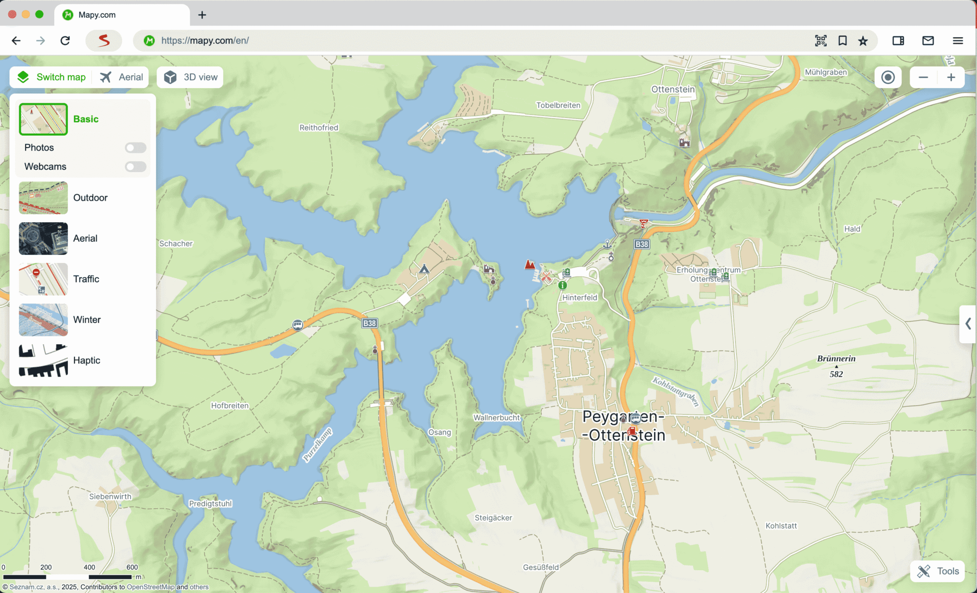
Basic Map
The Basic Map is a classic drawn map background, resembling most closely to maps from auto atlases. The map can be displayed in 3D view. It includes for example:
- Schematically simplified representation of the road network indicating one-way streets, traffic lights, and road markings
- Basic vegetation differentiation
- Objects such as shops, public transport stops, pharmacies, etc.
A list of objects displayed on the basic map can be found in the map legend.
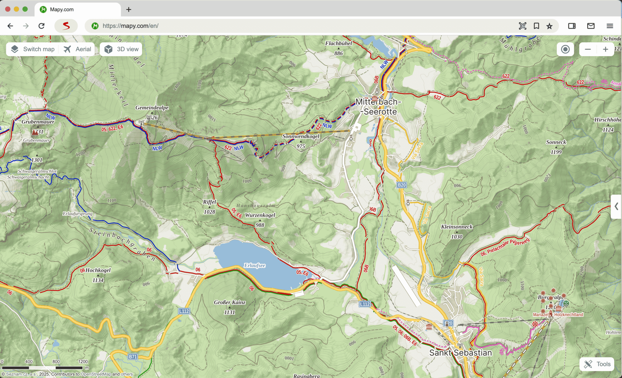
Outdoor Map
The Outdoor Map is a map background intended for planning trips and outdoor activities. Together with the Winter Map, it contains contour lines and shaded relief, unlike other map backgrounds, making this map background easier for terrain orientation and route difficulty assessment. The map can be displayed in 3D view. The Outdoor Map displays for instance:
- Outdoor routes (red, blue, green, and yellow) incl. long-distance trails
- Bike routes
- Outdoor places, such as castles, chateaus, observation towers, camps, hotels, restaurants, parking lots, and more
Contour lines are displayed with a basic interval of 5 vertical meters in the Czech Republic and 10 vertical meters abroad. A list of objects displayed on the outdoor map can be found in the map legend.
Aerial Map
The aerial map background in Mapy.com combines data from satellite and aerial images to depict the terrain at various levels of detail. It provides a detailed bird-eye view of landscapes and cities, facilitating orientation and route planning. With the archive of historical images, it’s also possible to track landscape changes over time. The map can be displayed in 3D view.

This is an aerial map, not aerial images only. Therefore, it includes texts and some other content above the map.
- Small zoom: The entire world is displayed using NASA Blue Marble Next Generation satellite image
- Closer zoom (outside CZ and SK): A mosaic of satellite images from the Landsat 7 satellite is displayed
- Czech Republic area: Orthophotos from aerial photography with a resolution of 12.5 cm/pixel are displayed. Updates occur every year, with half of the Czech Republic area updated annually (the entire Czech Republic is thus updated in a two-year interval)
- Slovakia area: Orthophotos from aerial photography with a resolution of 20 cm/pixel from 2020–2021 are displayed
- Other countries: Detailed orthophotos for Poland, Austria, Slovenia, Switzerland, Germany, and France are displayed. The data are obtained from state organizations in each country
- Archived images: For the Czech Republic, besides current aerial images, you can display historical aerial images from 2019–2021, 2016–2018, 2013–2015, 2010–2012, 2004–2007, 2001–2003 by clicking on the dropdown menu in the top left corner. For Slovakia, you will find historical images from 2017–2019, 2014–2016, 2011–2013
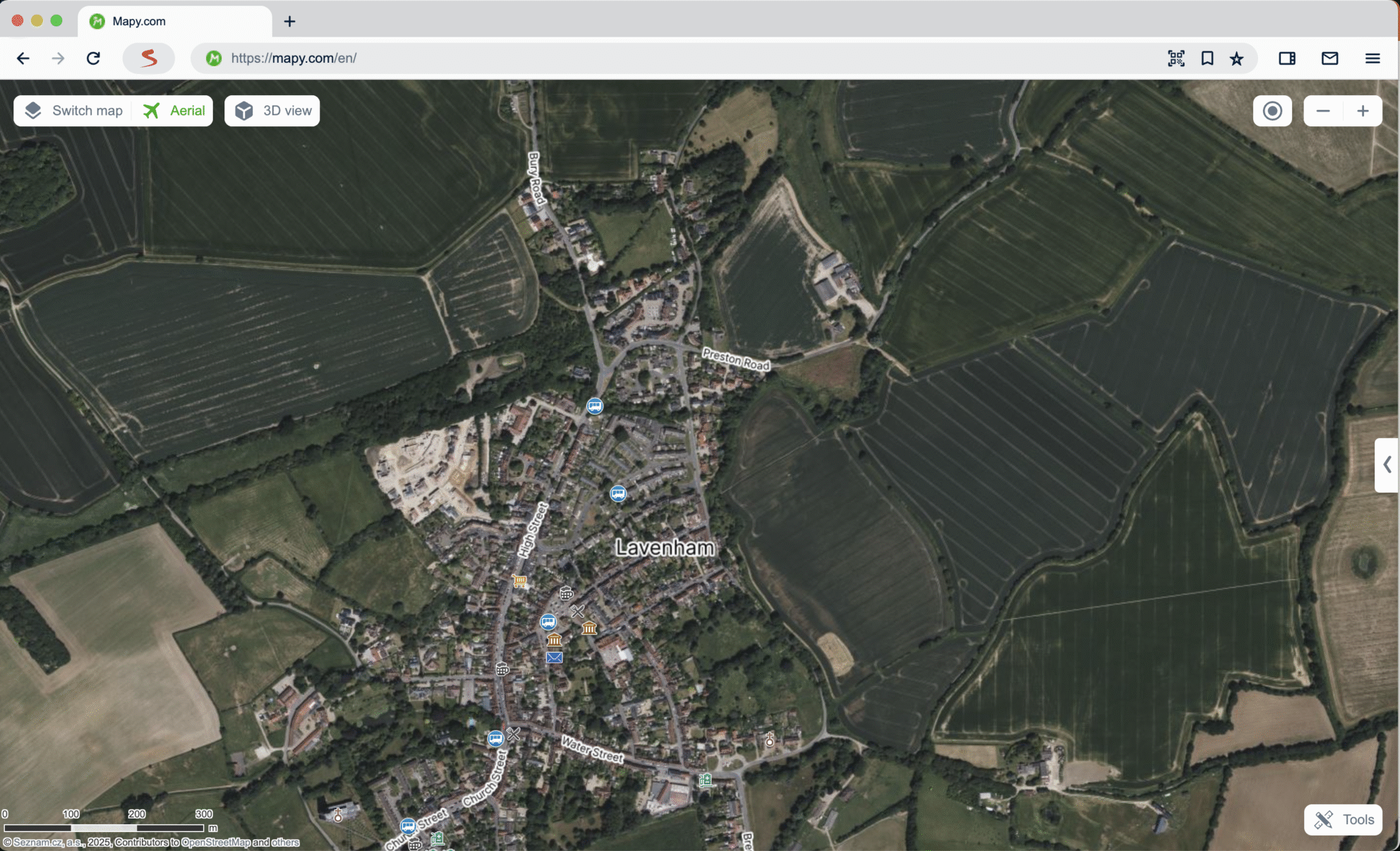

In the mobile app, the aerial map can only be displayed if you are connected to the internet, and it offers the option to view archived aerial images.
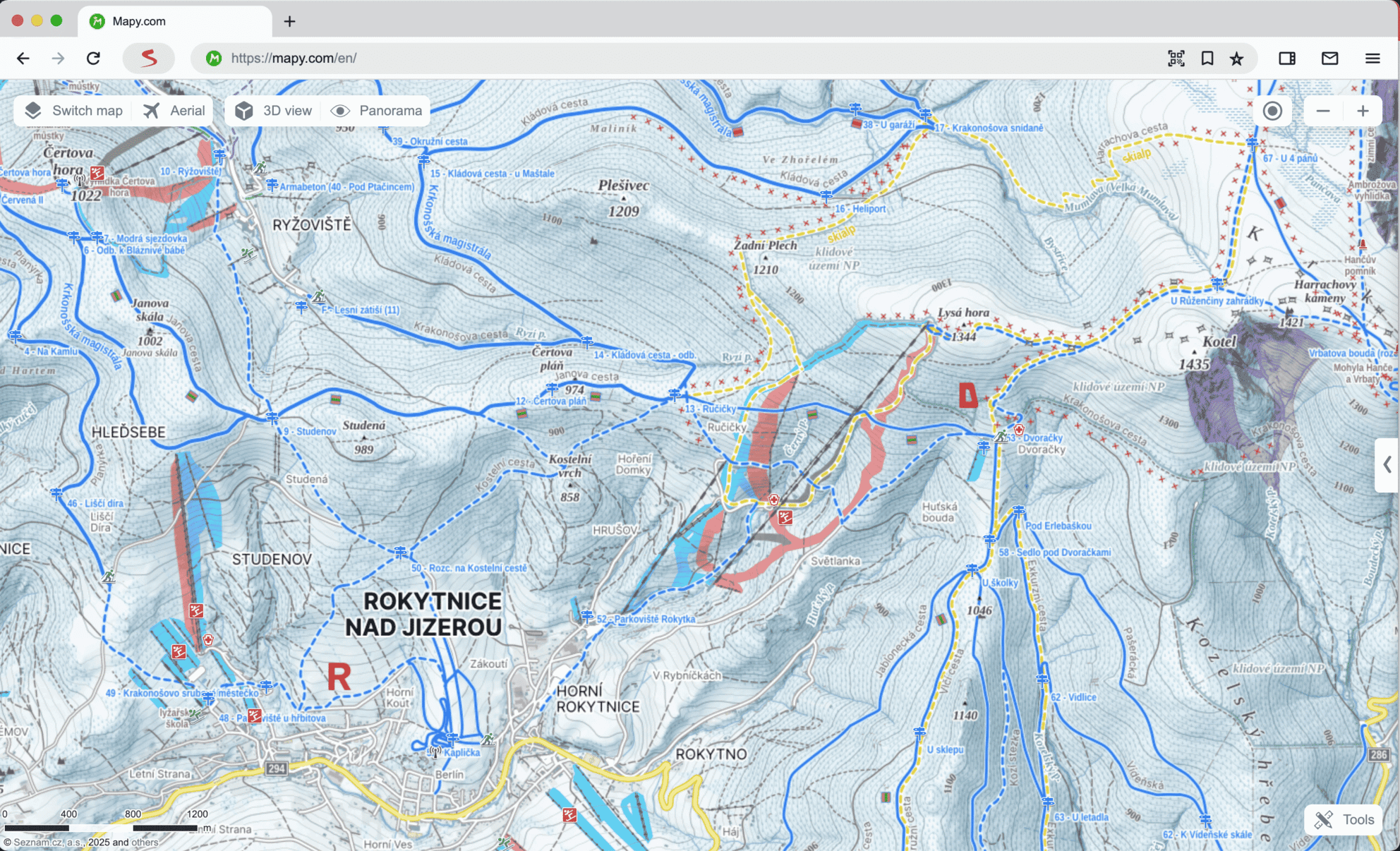
Winter Map
The Winter Map provides useful information for winter sports. It contains detailed descriptions of ski slopes (including difficulty and night lighting information), cross-country trails (distinguished by type), winter pole markings, and other supplementary content. The map can be displayed in 3D view.
For cross-country skiers:
- Information about trail types (backbone trails, groomed tracks, tourist trails, racing tracks)
- Mountain pole markings and “silent marks” for orientation, depicting goals in the Krkonoše Mountains
- Track maintenance data: On selected tracks, information about the last grooming is displayed, with color differentiation according to the age of the grooming (data available since the beginning of the winter season)
For skiers:
- Display of lifts
- Display of slopes differentiated by difficulty
- Information about night lighting
- Display of snowparks, bobsleigh tracks, and parking lots
- Avalanche slope alerts
A list of objects displayed in the Winter Map can be found in the map legend.
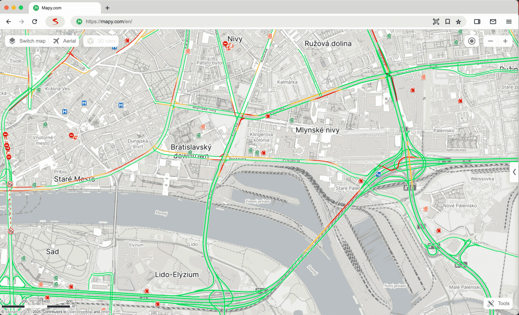
Traffic Map
The Traffic Map in Mapy.com is specially designed for motorists and offers comprehensive traffic information. It displays for instance:
- Current traffic information: Traffic accidents, closures, restrictions, roadworks, and other events on roads in CZ
- Current footage from traffic cameras on highways and selected roads in Prague
- Traffic density currently available in the Czech Republic, Slovakia, Poland, Germany, Austria, Slovenia, Italy, Croatia and Hungary
- Roads without winter maintenance and with mandatory winter equipment
- Useful points of interest: Information about parking lots, parking zones, charging stations, and gas stations including fuel prices
Traffic density and traffic restrictions are taken into account when calculating the optimal route and travel time for route planning. The background map is slightly desaturated for better readability.
Other Maps
Within the web application, beyond the above-mentioned map types, you can also select other specific backgrounds.
The Historical Map Background, Geographical Map, and School Atlas are displayed in the map type menu only over the territory of the Czech Republic and in the Czech version of the web application.
Map Legend
The map legend for each map background can be displayed by clicking on the Legend link in the bottom part of the right sidebar. The legend will change automatically after clicking on a different map background.
In the application, you can display the legend by clicking the Legend button, located below the About the application link available after clicking on the menu symbol in the bottom left corner of the screen.
Data Sources and Their Currency
Data for the Czech Republic are completely created and managed by the cartographic editors of Mapy.com, while the rest of the world comes from OpenStreetMap. The cartographic editors strive to keep the map continuously updated; however, it may happen that the map does not reflect the real condition in the field. Discrepancies/feedback can be reported via feedback.
Terms and Licensing
If you wish to use map backgrounds from Mapy.com for your project (e.g., online on your website or as a screenshot in a printed publication, etc.), you must comply with the rules for using map backgrounds, which you can find in the terms and licensing.
Didn’t find your answer?
Check out what people are saying in the forum. They share their questions, tips, and experiences to make Mapy.com even better.